Home/Commercial Drone Services
Division 02
Aerial intelligence for your business.
Professional drone services for construction, roofing and real estate, delivering aerial imagery and project documentation tailored to your operational needs.
How we think about this work
You are not buying a drone flight
You are buying a record of your site on a date, a set of images your estimator can open, or listing media that gets a property clicked. The aircraft is just how we get there.
So we scope backwards from the output. What do you need in hand, in what format, by when — and we plan the flights around that. It sounds obvious. It is also the part most vendors skip.
Four service areas
What we do commercially
Construction, roofing, real estate and mapping. Most clients use one; developers and general contractors often end up using three.
Construction
Progress photography, site documentation and periodic monitoring across a project's life.
Roofing
Aerial roof photography and visual documentation, including areas that are awkward to reach.
Real estate
Aerial property photography and video that show the setting, not just the facade.
Mapping & photogrammetry
Orthomosaics, models and datasets — when the project, equipment and conditions support it.
Service A
Construction drone services
For general contractors, construction companies, developers and project managers who need the site documented consistently instead of in whatever photos the crew happens to take.
What we fly
- Aerial progress photography on a schedule you set
- Construction site documentation, wide and detail
- Periodic project monitoring — weekly, monthly or milestone-based
- Visual records of existing site conditions before work starts
- Aerial video for project presentations and owner updates
- Mapping and photogrammetry, subject to project requirements and technical feasibility
What it gets you
- Documented progress you can put side by side with the schedule
- Fewer miscommunications between field, office and client
- A consistent visual archive instead of scattered phone photos
- Sharper project presentations and easier owner reporting
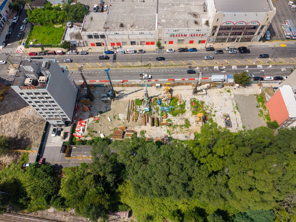
Site documentation
One flight gives you the whole site, the stockpiles and the neighbouring buildings in context.
Flight windows depend on weather, airspace and site activity. We plan around your schedule, but we will not fly when conditions or site rules say no — and we will tell you as early as possible if a date has to move.
Service B
Roofing drone services
For roofing companies, contractors and property professionals who need the roof documented without sending someone up a ladder for a first look.
- Aerial roof photography, including full elevation views
- Visual documentation of roof conditions as they appear
- Documentation of hard-to-access roof areas and complex geometry
- Project progress imagery from first tear-off to final course
- Before-and-after documentation for the same property
- Visual material for estimates and customer presentations
What aerial imagery is and is not. Drone photos can complement an inspection and give you a clear look at surfaces, edges and penetrations. They do not automatically replace a physical evaluation, a certified inspection or a technical diagnosis. We will not tell you a roof is sound, or that a defect exists, beyond what the images in the agreed scope actually show.
Service C
Real estate drone services
For agents, brokers, owners, developers and real estate marketing professionals who need a listing to stand out in a feed of ground-level photos.
- Aerial property photography, exterior and context
- Drone video for property listings and walkthrough intros
- Exterior property documentation, including roofs, grounds and outbuildings
- Neighbourhood and surrounding-area visuals
- Marketing content for residential and commercial properties
- Aerial footage for property presentations and developer decks
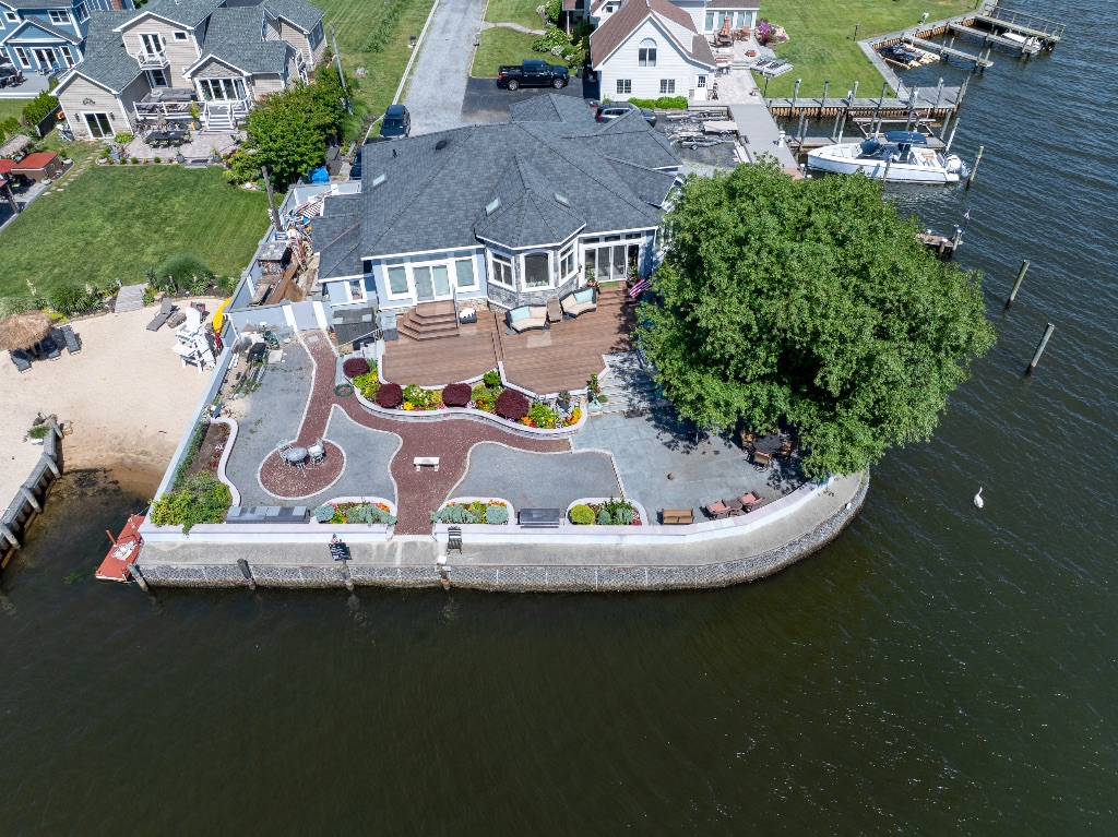
The value is perspective. A ground shot shows the front door. An aerial shot shows the lot line, the water behind the house, the access road, the school two blocks over — the things a buyer is actually trying to picture. Conventional photography stays in the mix; this just covers the angles it cannot.
Waterfront listing
Roof, deck, dock and grounds in a single frame — the setting does the selling.
Commercial context
Useful for developer decks and site-selection conversations, not just listings.
Service D
Mapping & photogrammetry
A technical capability we bring in when the project, the equipment, the software and the operating conditions all allow for it. Ask early — this is the service that most often needs a real conversation before anyone quotes anything.
Possible deliverables
Aerial image datasets
Overlapping, geotagged image sets collected on a planned flight grid.
Orthomosaic maps
A single corrected, scaled image of the site assembled from many photographs.
3D reconstructions
Point-cloud and mesh models of a structure or site, where capture conditions support them.
Surface models
Digital surface representations for visualisation and comparison over time.
Site visualisation products
Rendered views and overlays for presentations, planning conversations or marketing.
Other agreed outputs
If you need a specific format or product, put it in the scope and we will confirm feasibility.
On accuracy claims. We do not promise survey-grade precision, engineering-grade results or certified products. Those depend on the specific equipment, ground control, procedures and professional requirements involved — and they have to be confirmed for your project, not assumed. What we will do is tell you honestly whether the output you need is something this scope can support.
Service E
Project workflow
Six stages, in order. Every project gets a defined scope, deliverables, calendar and commercial terms agreed before the first battery is charged.
-
01
Initial consultation
What you need, where the site is, when you need it, and what the output is for.
-
02
Scope definition and operational feasibility
Deliverables, formats, flight count, access requirements — and a straight answer on what is realistically achievable.
-
03
Flight planning and safety review
Airspace, site survey, weather windows, people on site, and the operational plan for the day.
-
04
On-site aerial operations
We fly the plan, coordinate with your site contact, and adapt if conditions change.
-
05
Image processing
Included when the scope includes it — culling, correction, stitching or model generation.
-
06
Delivery of agreed files and documentation
Your files, in the formats agreed, with a short written summary of what was captured.
Request a project quote
Tell us about the project
The more you can tell us about the site and the output, the more useful our first reply will be. Not sure about a field? Skip it.
Also from Drone Service
Want your own team flying instead?
Our training division builds drone programs for organizations and prepares professionals for commercial operations — including FAA Part 107 exam preparation.